If you have Garmin Mapsource and Garmin Bluechart Maps use the select maps function and select all the Bluechart Ireland Maps.
Now Export these Maps to an SD type memory card (about 25Mb). You will need a card reader or a built in SD slot on you PC.
Plug the SD card into your Garmin Car Sat Nav. Turn the unit on.
Go to settings (spanner) then Map icon, them Map Info Tab You will see 2 types of Maps. The city maps and your Bluechart Maps.
Turn off the city maps and select the Bluechart Maps. [you can't run 2 maps at the same time]
Run the unit in off Road mode. settings (spanner) then Navigation icon
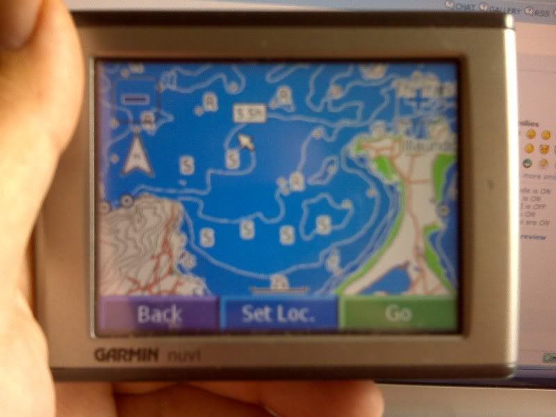
You will now see all the contour lines, Reefs, buoys, Wrecks & various other bits.. You will not see the depths displayed on the screen as you do in you GPS unit, buy if you touch on Any Contour Line it will display the min & / max depths.
I managed to load the Bluechart maps onto my Garmin Nuvi 310. I was recently away in Brandon for a week and my main GPS unit was acting up. I managed to work around it perfectly, using the Car Sat Nav and Mapsource in the PC for the finer detail in the evenings. I even rigged a 12V output to Charge the Sat Nav unit
Sorry for the crappy pics. My Blackberry doesn't like close ups.
Howth in Close
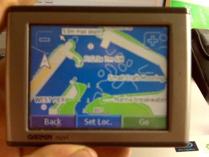
Brandon Bay